Scandinavia Weather and Precipitation Map
What Will the Weather in Scandinavia Be Like on Your Vacation?
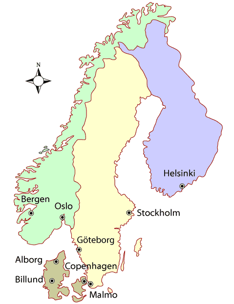
Click or tap the city dots on the Scandinavia climate map below to see the current weather and historic climate information for that Scandinavian city.
Scandinavia: Annual Average Precipitation Map

Precipitation map © Climatic Research Unit, University of East Anglia
Scandinavia Travel Weather - When to Go to Scandinavia
Scandinavia's climate is quite complex, but let's start with the basic plus: You probably won't swelter in August in Scandinavia. Summers are usually quite pleasant. Expect some rain.
Here are some generalities. The weather in Denmark and southern Sweden is much like the north of Germany, a marine west coast climate. The center of Sweden is a humid continental climate becoming subarctic as you go north. The south of Sweden and the west coast of Norway offer a mild costal climate with lots of precipitation, especially in the winter.
Planning a trip to Scandinavia based on typical weather? Use our Scandinavia weather map to click on the city you're interested in to get graphs of the high and low historic temperatures, rainfall and the latest weather conditions. Below are the links to major tourist cities with historic climate information, in case you can't use the map.
Sweden Month to Month
Here are some temperature averages taken across cities in the Scandinavian country of Sweden over 25 years.
- January - 23 Degrees Fahrenheit (°F)
- February - 22
- March - 29
- April - 36
- May - 47
- June - 55
- July - 61
- August - 58
- September - 51
- October - 41
- November - 32
- December - 26